Skip to Content
Stamped-pattern channel wall Boneyard Creek Park meets the vegetation below while a girl strolls along a path on the adjacent side of the creek

Aerial view of the Boneyard Creek from a drone shows the pedestrian bridge connection to the road, with the creek snaking underneath the vehicular bridge.

Before and after image of the creek before the park and creek restoration. Before, the Boneyard Creek is an industrial looking waterway with a chainlink fence keeping people out. Today, vegetation lines the creek edge, with a park that allows safe access to the water's edge.

A green lawn slopes to the creek, terraces and steps lead down to the creek edge and from the street and shopping district above.

Terraces with large planters and steps lead visitors to the creek along a stone bridge abutment

An old bridge was repurposed as a pedestrian bridge over the creek with cream-colored stone abutments matching the sitewalls below.

A young girl walks past a gabion wall filled with recycled wood trusses from the project area.

A path winds from the top of the urban area down to the creek edge and back up past stamped patterned walls and lush vegetation.

A path winds from the top of the urban area down to the creek edge and back up past stamped patterned walls and lush vegetation dotted with pink flowers.

View from bridge of steps and planting terraces down to Boneyard Creek.

A green vertical grass wall lines one edge of the path down to the creek's edge.

slider_arrow_left
slider_arrow_right

Boneyard Creek Improvements

Urbana, Illinois

Linear park provides access to a once untouchable creek.

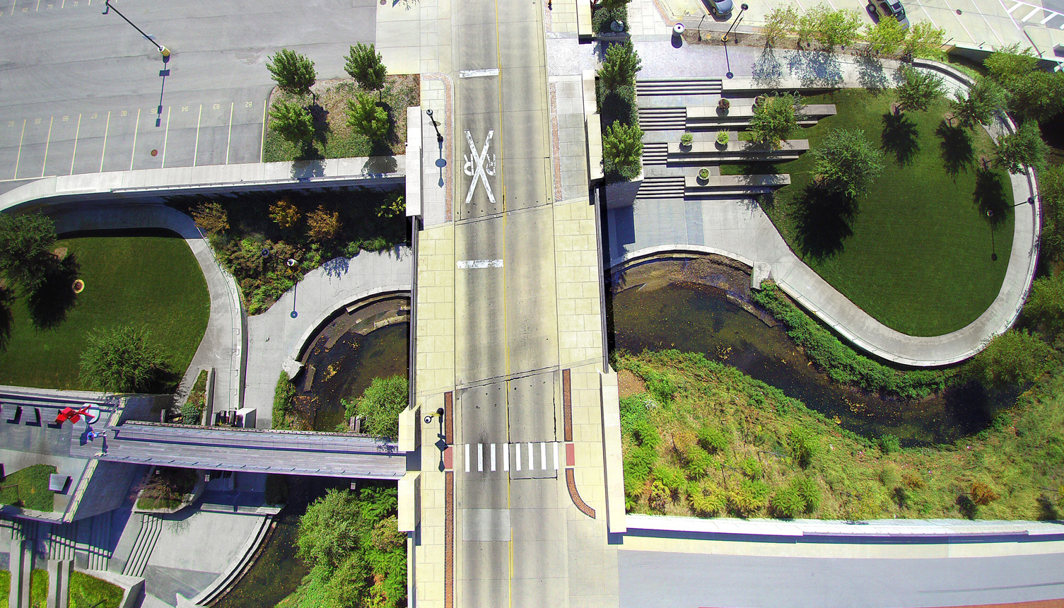
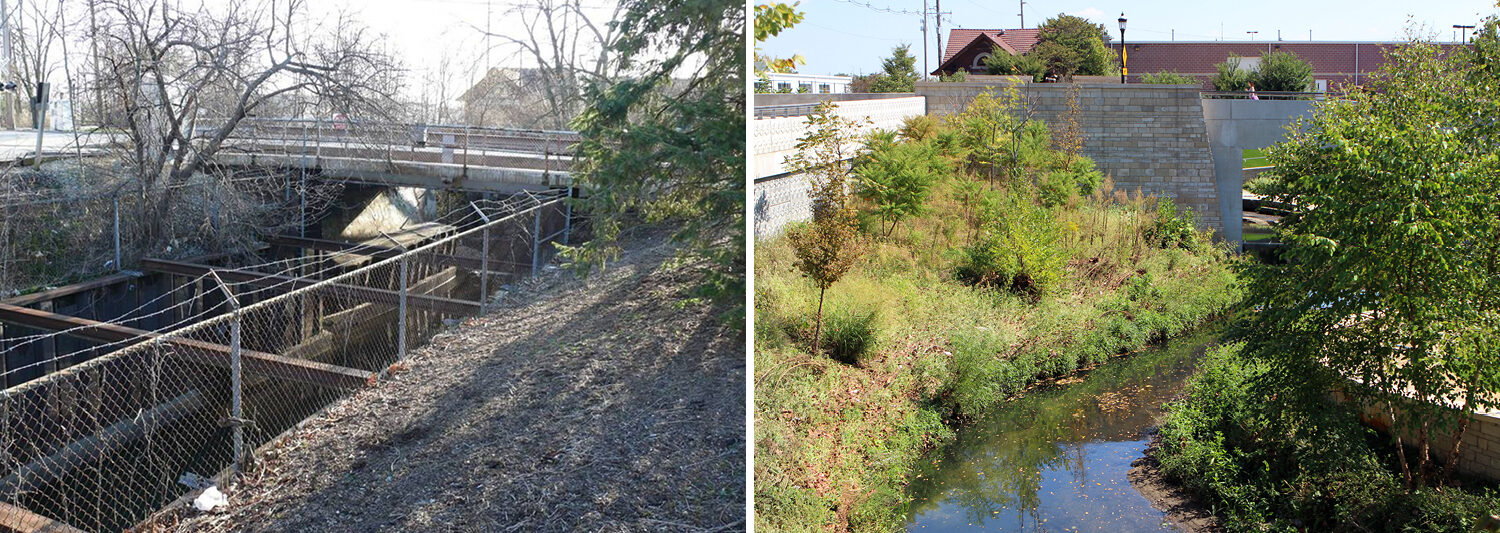
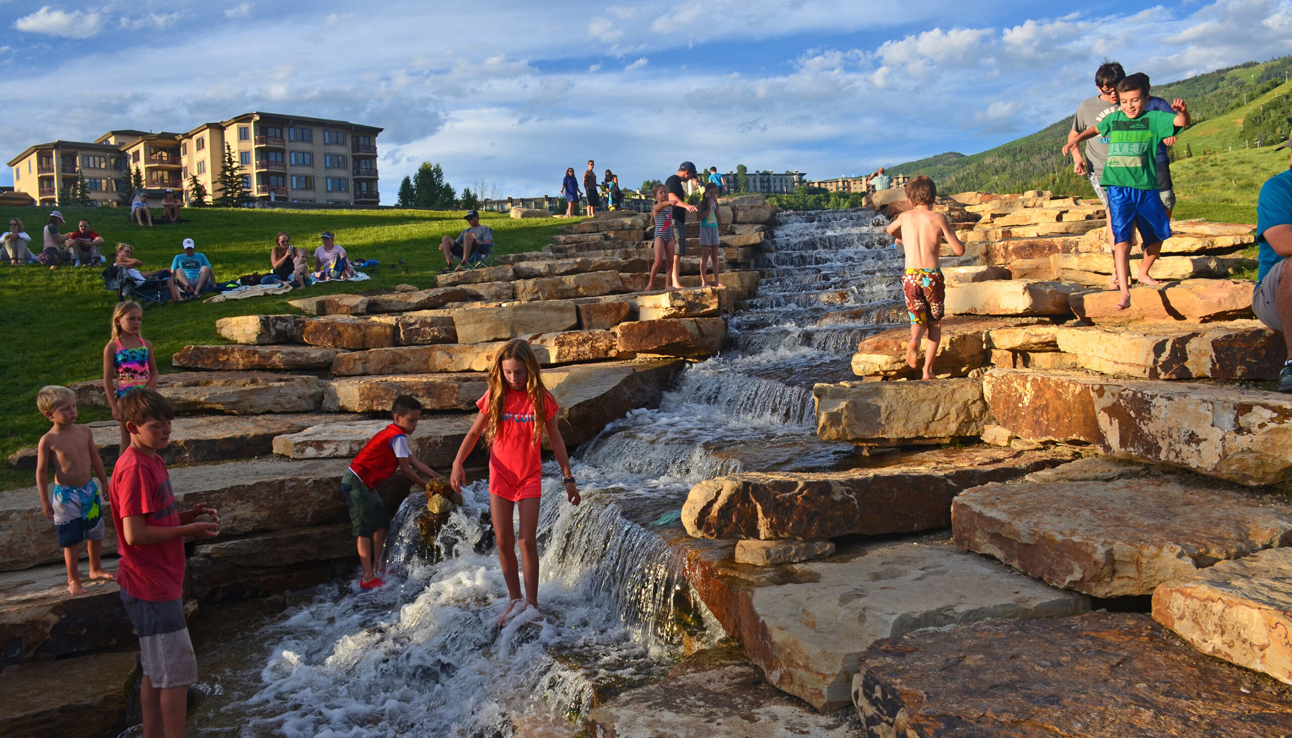
For over a century, Boneyard Creek was a hazardous, flood prone, walled stormwater channel winding through downtown Urbana, Illinois. Wenk Associates developed a master plan and construction documents for restoring a ¼-mile section of the creek to an open, flowing stream and linear park, with proposals for redevelopment of private development sites along the creek edge.

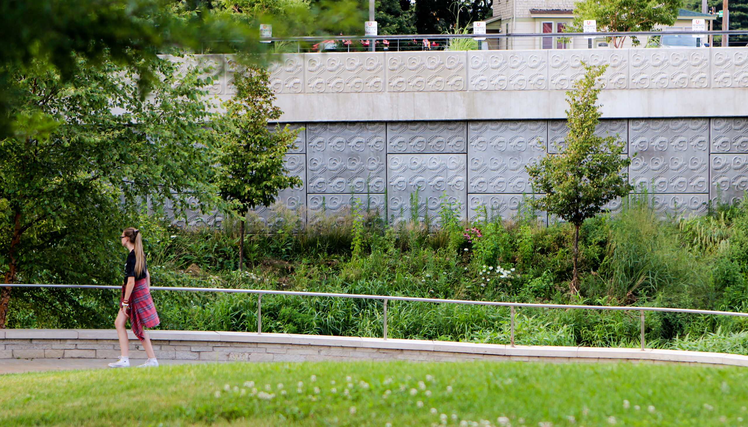
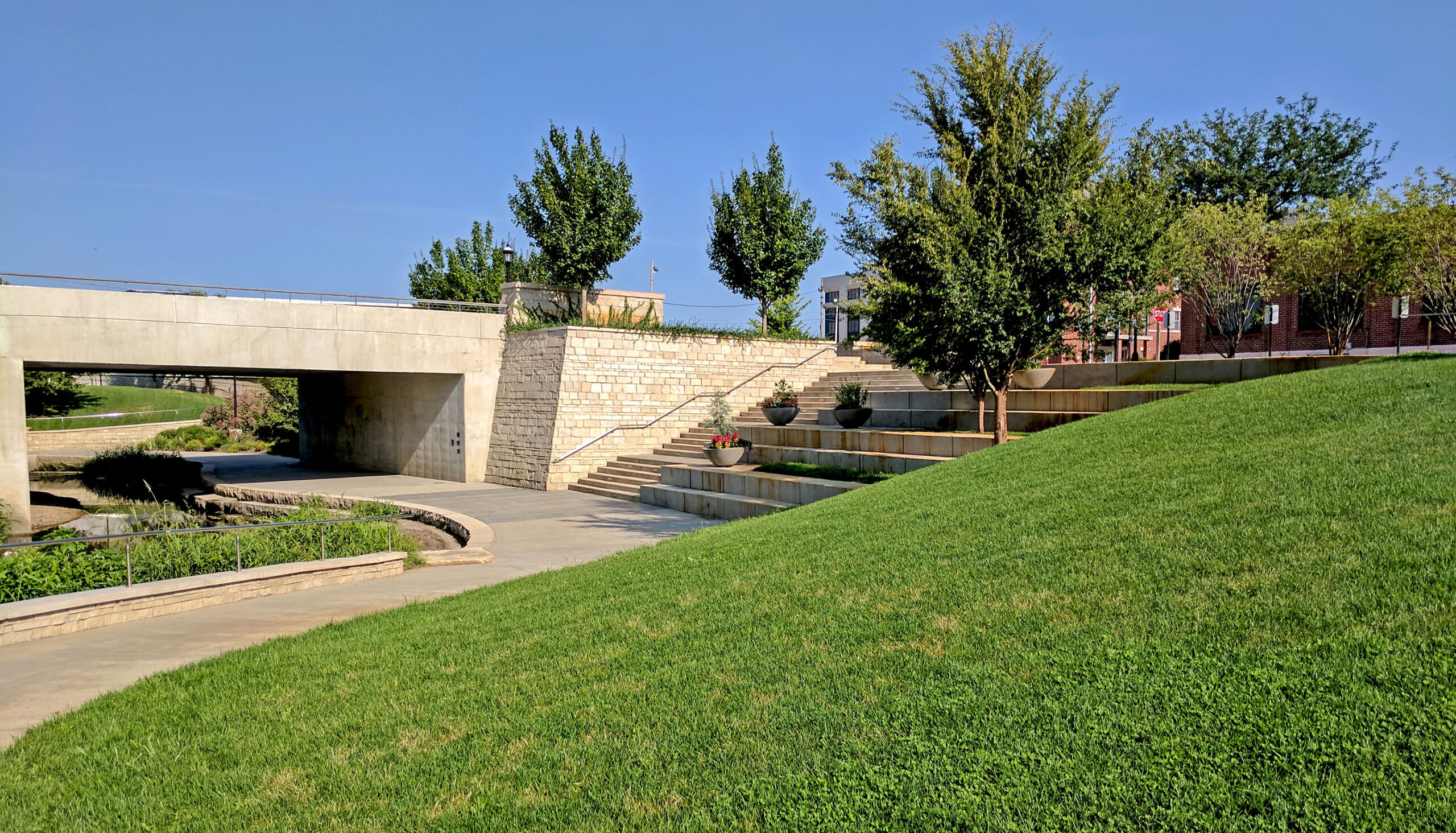
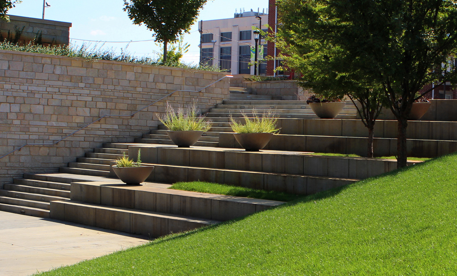
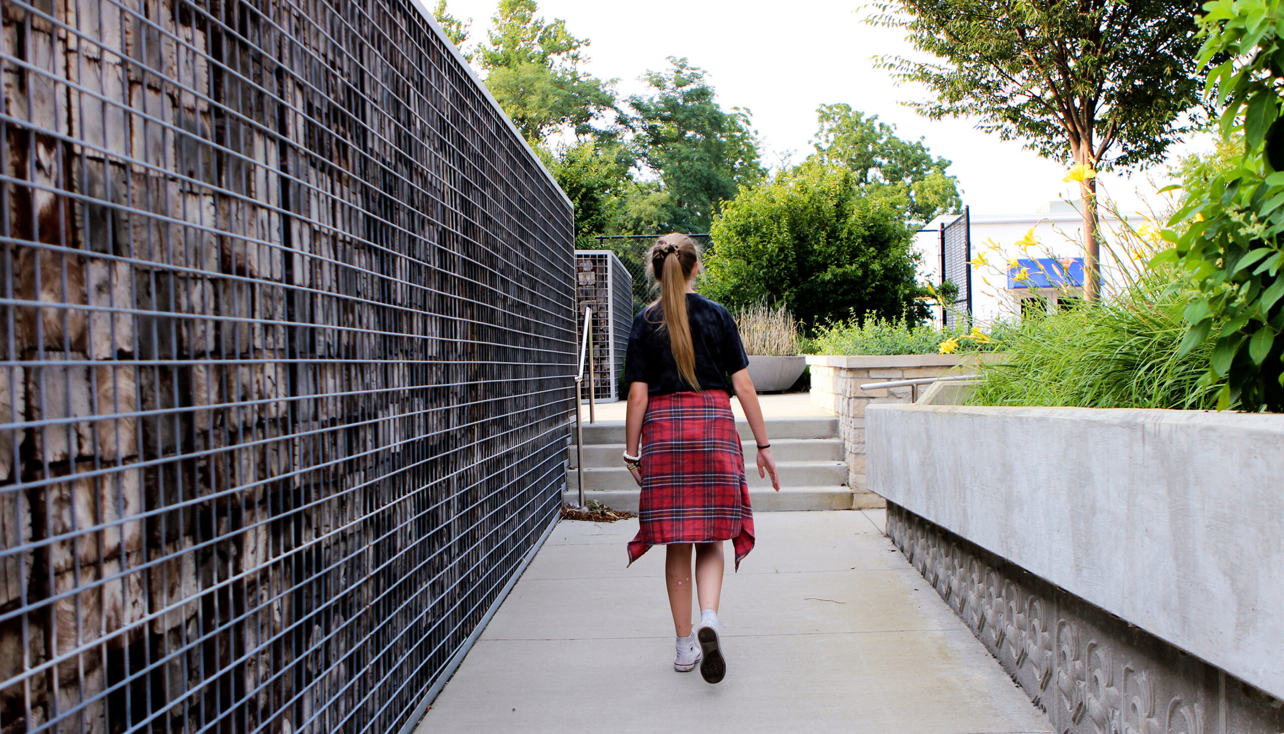
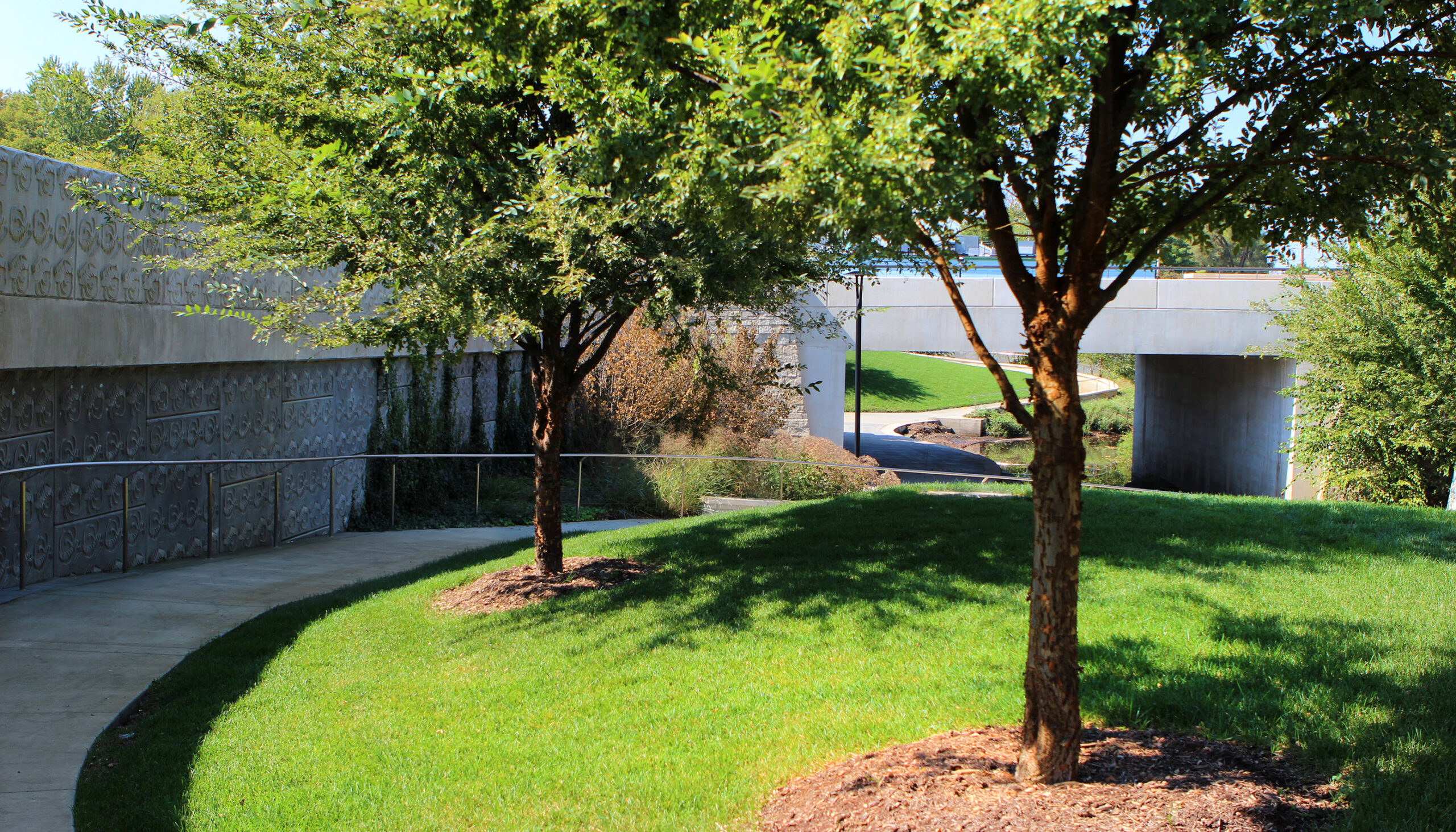
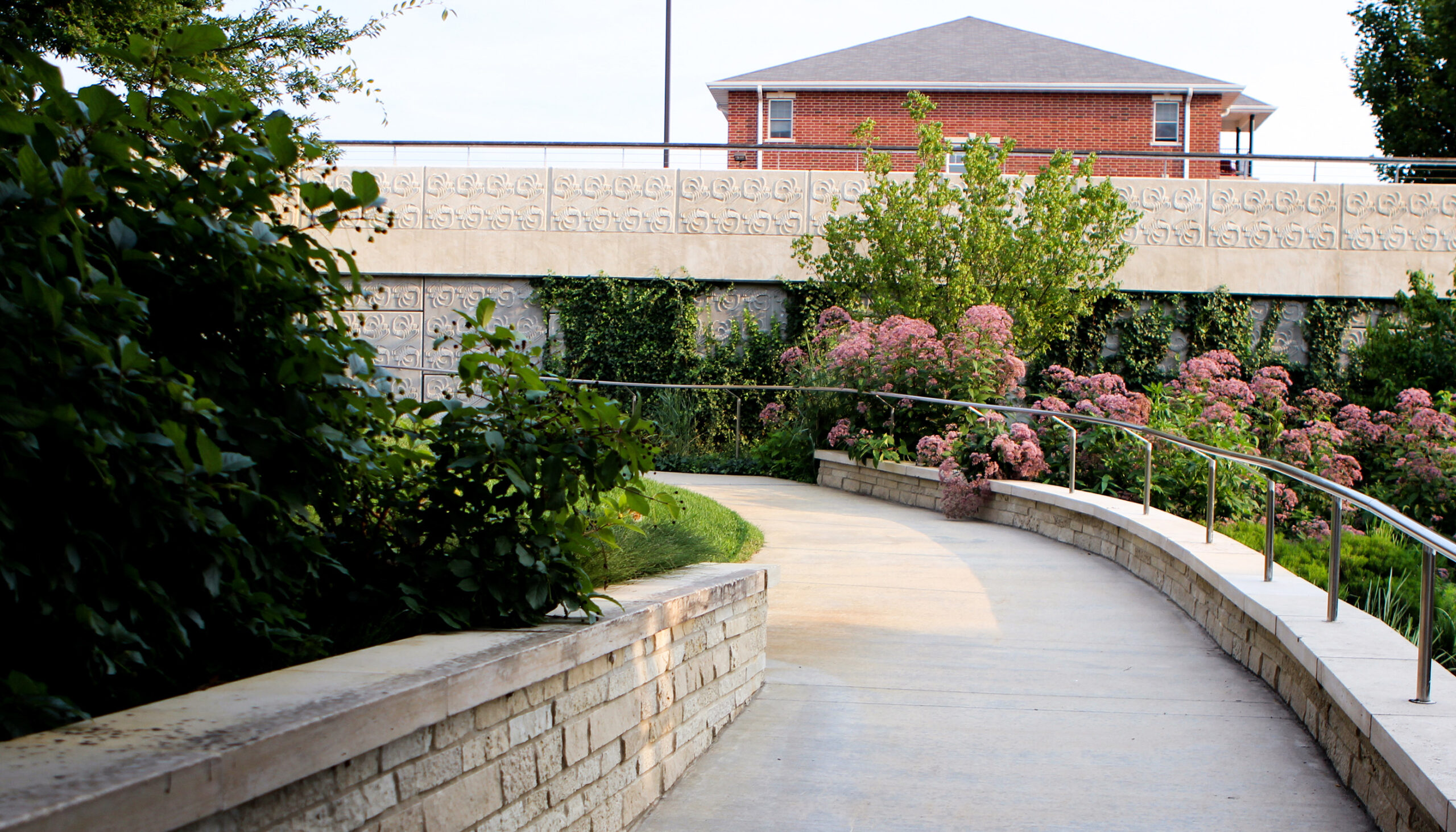
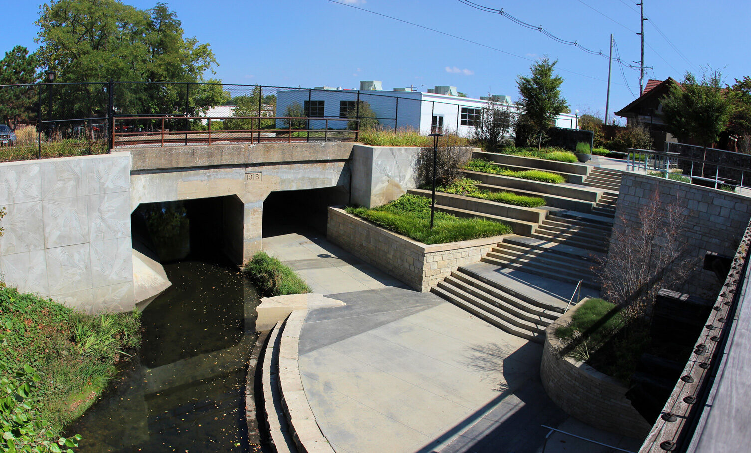
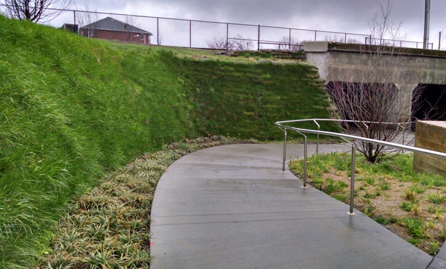
Boneyard Creek Park which is sandwiched between two roads, is located on a site of significant grade change between the streets and the creek. The restored creek channel and banks enhance the flood conveyance and manage the ten-year flood event all while creating multiple opportunities for access to the creek’s edge. Through the use of creative grading, the addition of attractive terraces and a series of usable walls, accessible routes were created to the once untouchable creek.

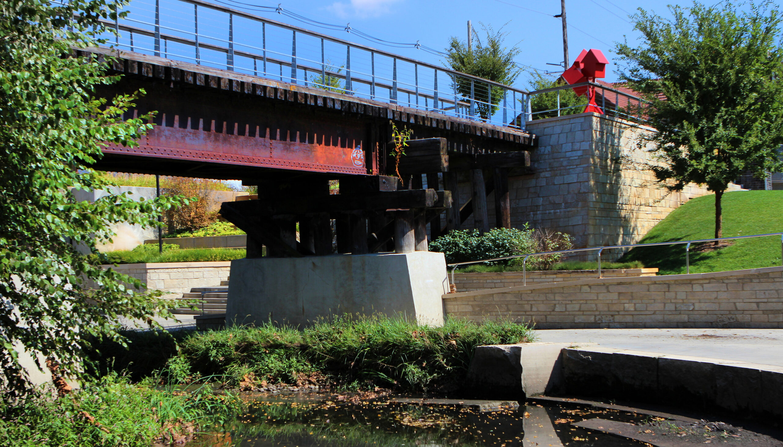
The linear park spaces include trails, mounded landforms for informal seating, picnic and gathering areas, and a small event space offering opportunities for daily use and scheduled events. Reuse of a turn-of-the-century railroad bridge creates a pedestrian connection to redeveloped spaces at the street level.

Client

City of Urbana, IL

Completion year

2016

Awards

DesiAmerican Public Works Association (APWA) Award - Illinoisn Award of Distinction, American Institute of Architects (AIA) Colorado, 2019

Chapter, Environment ($5-25 Million Award), 2016

Preservation and Conservation Association of Champagne County, Heritage Award, 2015

Related Work

3D illustrative bird's eye rendering of the grand central plaza space with access to the river's edge
The River Mile Redevelopment

Denver, CO

A multi-tiered plaza descends from industrial buildings to the water's edge with interspersed planting areas.
Confluence Park

Denver, CO

kids enjoy playing in the stone, slot-canyon waterfall-inspired water feature tucked into the mountain slope
Steamboat Base Area Redevelopment

Steamboat Springs, CO

Wenk Logo SVG graphic
Privacy Overview

This website uses cookies so that we can provide you with the best user experience possible. Cookie information is stored in your browser and performs functions such as recognising you when you return to our website and helping our team to understand which sections of the website you find most interesting and useful.