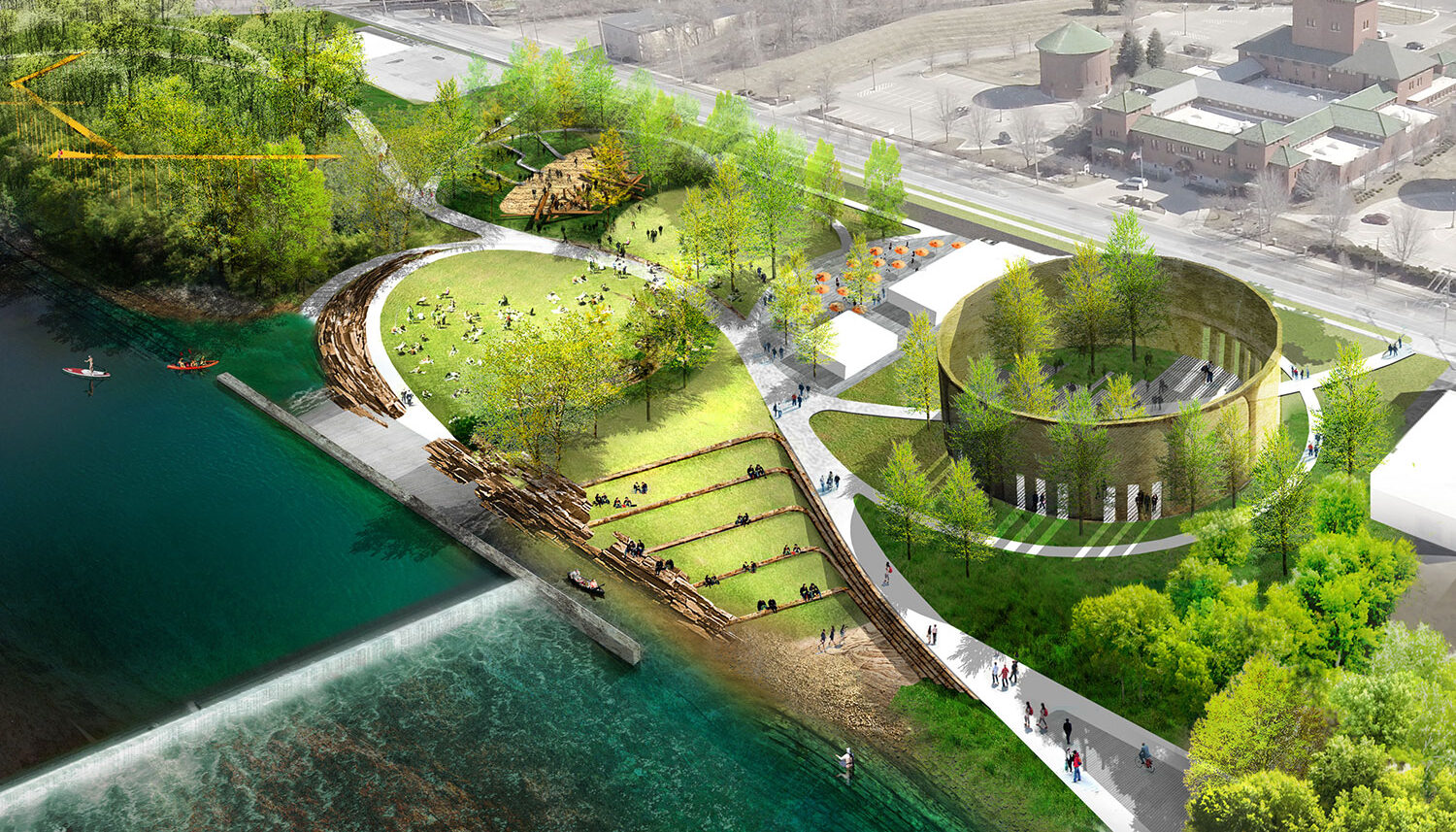

Grand River Corridor: A ‘River for All’
Grand Rapids, MIImplementation plan and river trail design guidelines for the 7-mile Grand River corridor in Grand Rapids, Michigan
The City of Grand Rapids has recognized the value of the Grand River as an important natural asset through decades of planning processes. Through years of city-wide, citizen-driven planning initiatives, the community has developed a clear and widely supported vision for the future of the Grand River Corridor, transforming the river from an underutilized asset into a distinct civic amenity that delivers far-reaching regional economic, environmental, and social benefits. The forward-thinking strategy for the river corridor will create a safer waterway, protect vulnerable homes and businesses from flooding, leverage substantial private investment in new development, and revitalize the dividing river of east and west into a central gathering place for the entire community to enjoy.
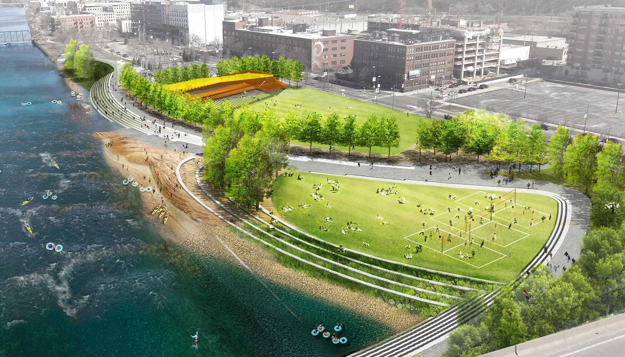
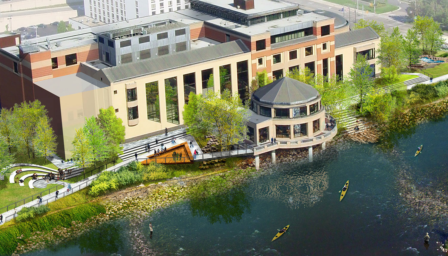
Wenk Associates led a multi-disciplinary team to build upon previous planning efforts and develop design guidelines for trails, parks, and open spaces along a 7.5-mile segment of the Grand River and generate schematic designs for six new public parks along the riverfront. A robust public participation program involved residents and stakeholders spanning all quadrants of the community, ensuring that many voices were represented during the process.
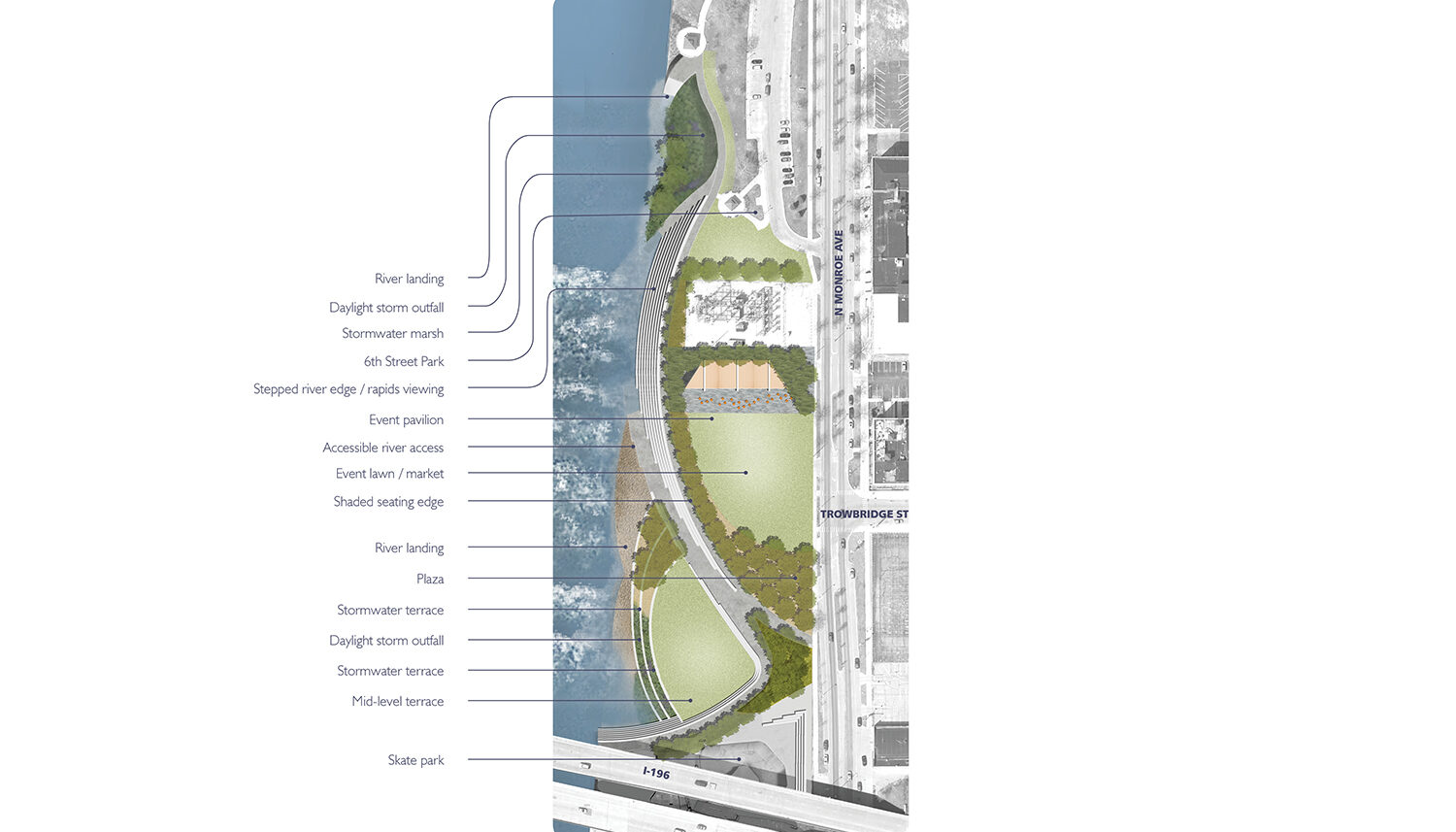
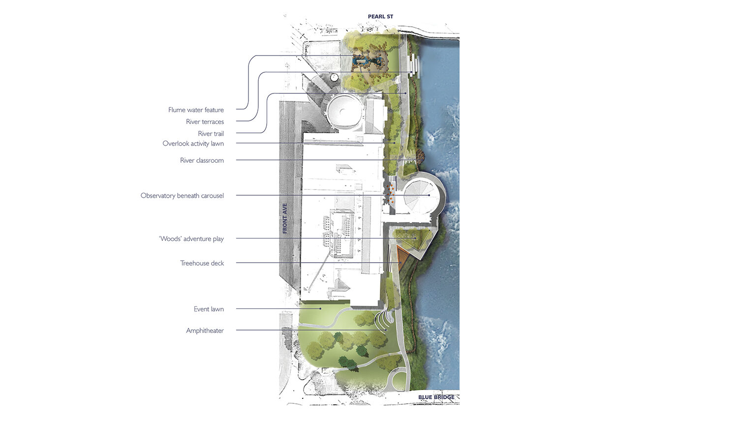
The graphic-intensive design guidelines manual serves as a “menu list” to guide City staff, private developers, and decision makers in creating a cohesive river corridor trail system that is integrated into the diverse character districts along the corridor and accessible. The plan capitalizes on the future ‘rapids’ restoration efforts to expand recreation opportunities along the corridor, and provides guidance to create a connected network of diverse upland, riparian, and riverine habitat areas. Concept designs were completed on six river-adjacent opportunity sites that demonstrate how the guidelines might be implemented to create public spaces that activate the river corridor.
Project Team:
Wenk Associates – Lead Consultant, Landscape Architect
Viridis Design Group – Local Landscape Architect
Fishbeck, Thompson, Carr & Huber, Inc. (FTCH) – Civil Engineering
Williams & Works – Public Outreach
ETM Associates, LLC – Asset Management
Client
City of Grand Rapids, MI
Completion year
Ongoing
Related Work
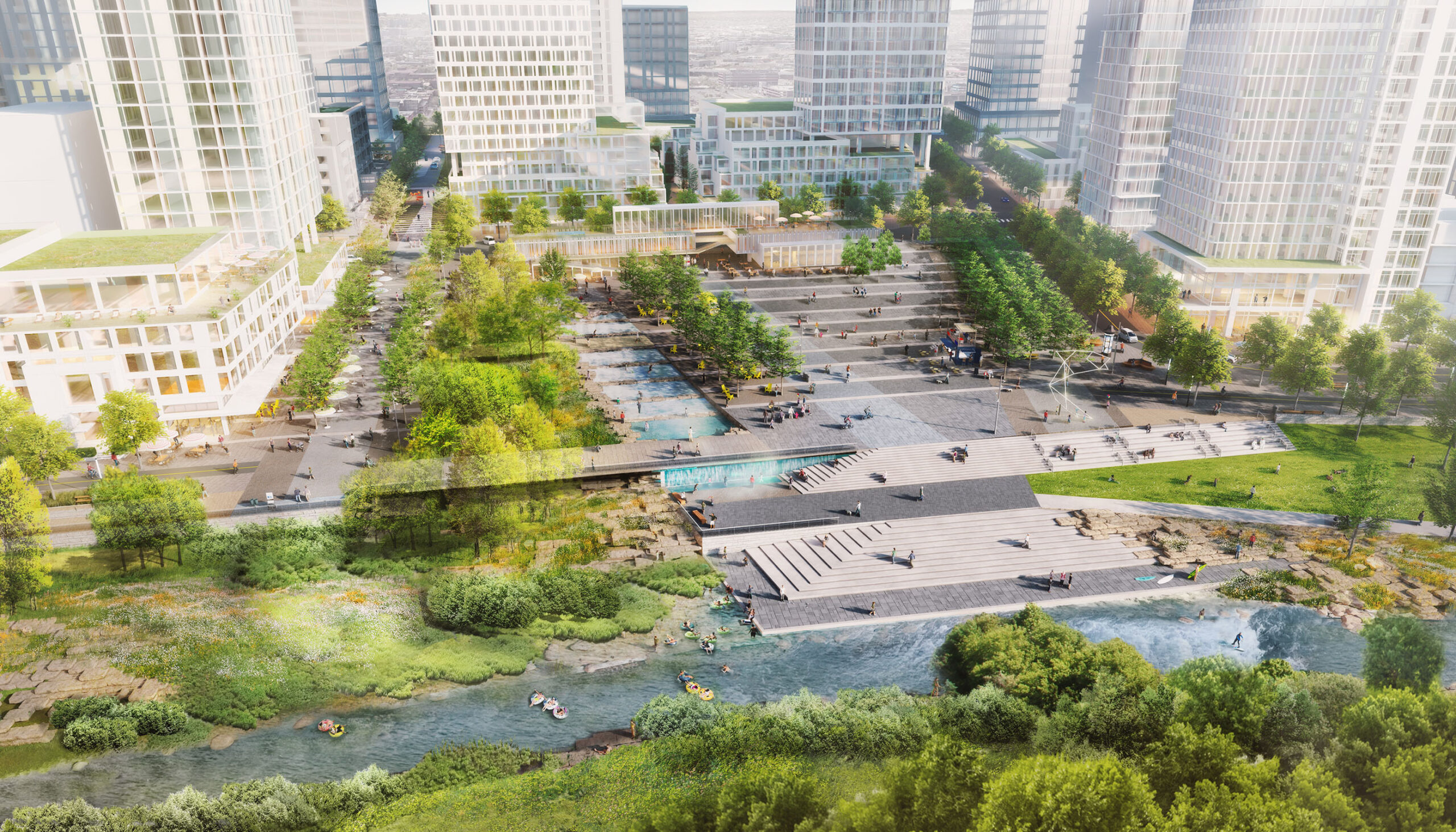
The River Mile Redevelopment
Denver, CO

Confluence Park
Denver, CO
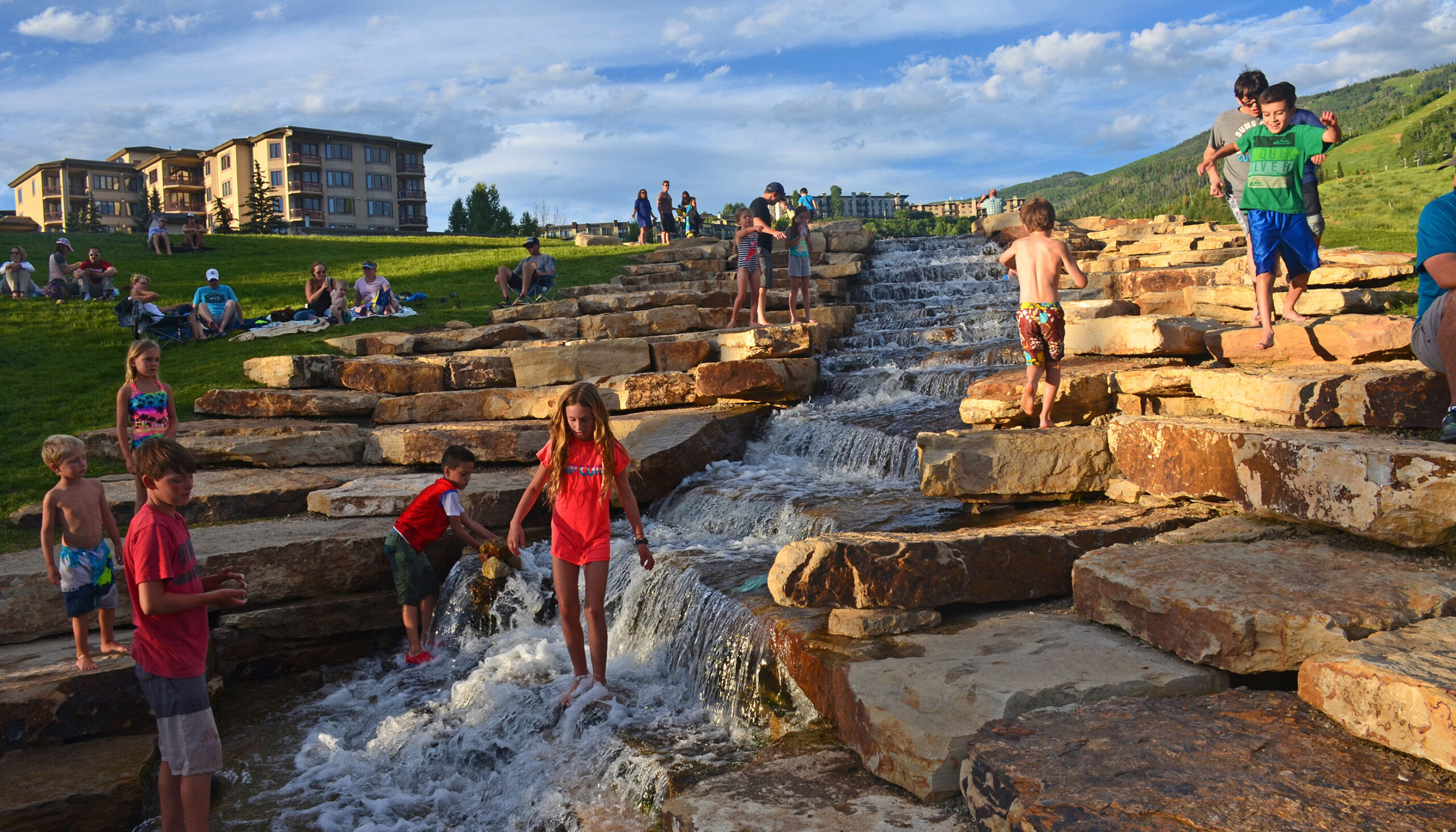
Steamboat Base Area Redevelopment
Steamboat Springs, CO