Los Angeles River Revitalization Master Plan
Los Angeles, CATransforming 32 miles of concrete-lined river into public green space
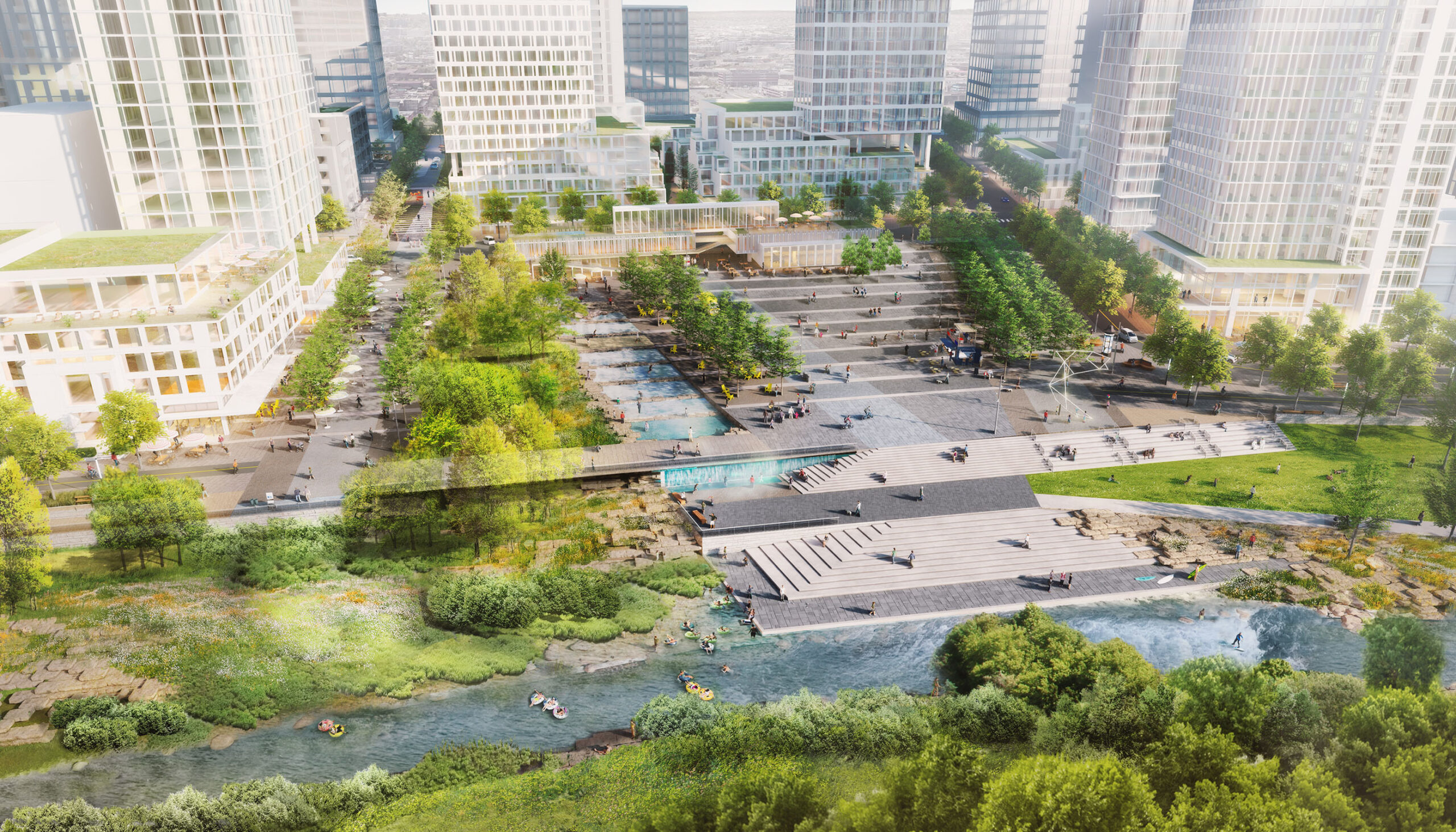
The Los Angeles River Revitalization Master Plan represents a milestone achievement for Los Angeles in its massive scope – transforming 32 miles of concrete-lined river into public green space, in the heart of one of America’s densest cities – and in its ability to bring together hundreds of diverse stakeholders around a progressive and ambitious revitalization agenda. A bold commitment was made to restore riparian habitat and to reconnect park-poor neighborhoods to river green space. Guidelines for stormwater management and sustainable, river-oriented building advanced the City’s “green agenda.”
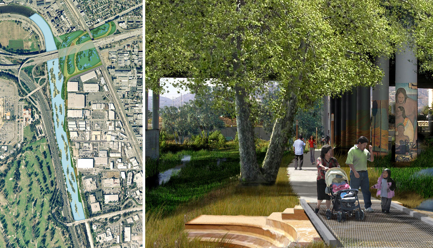
The Plan proposed to reclaim over 750 acres along the concrete-lined Los Angeles River channel for multiple-benefit uses, including restored riparian habitat, stormwater runoff treatment, a new interconnected network of parks and trails, and river-oriented redevelopment.
Plan recommendations address five broad, interrelated ideas:
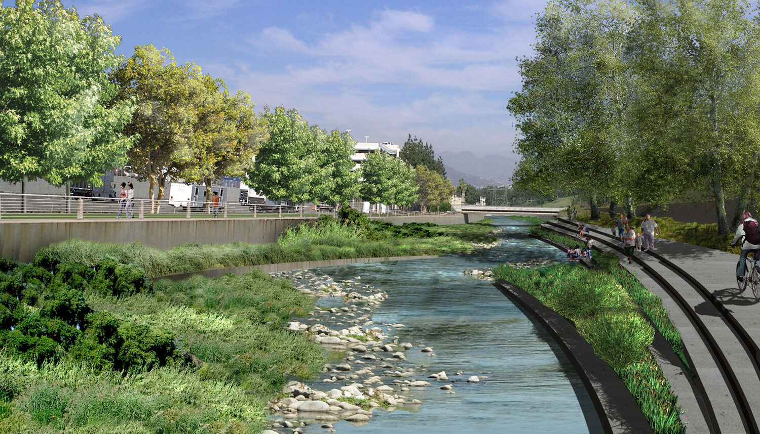
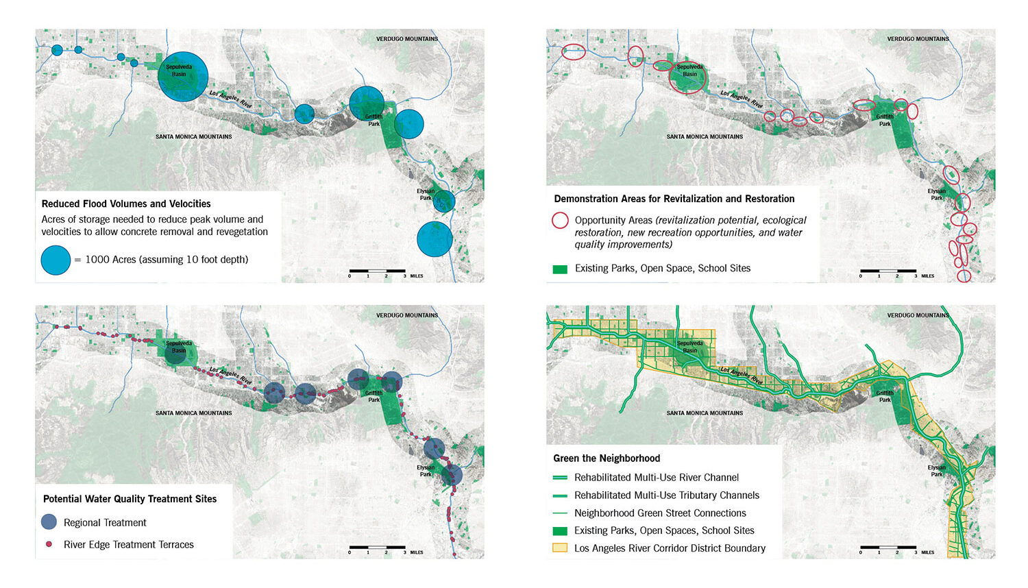
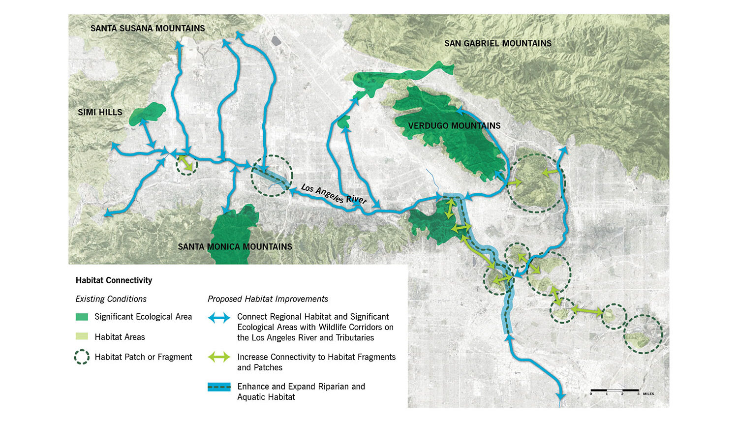
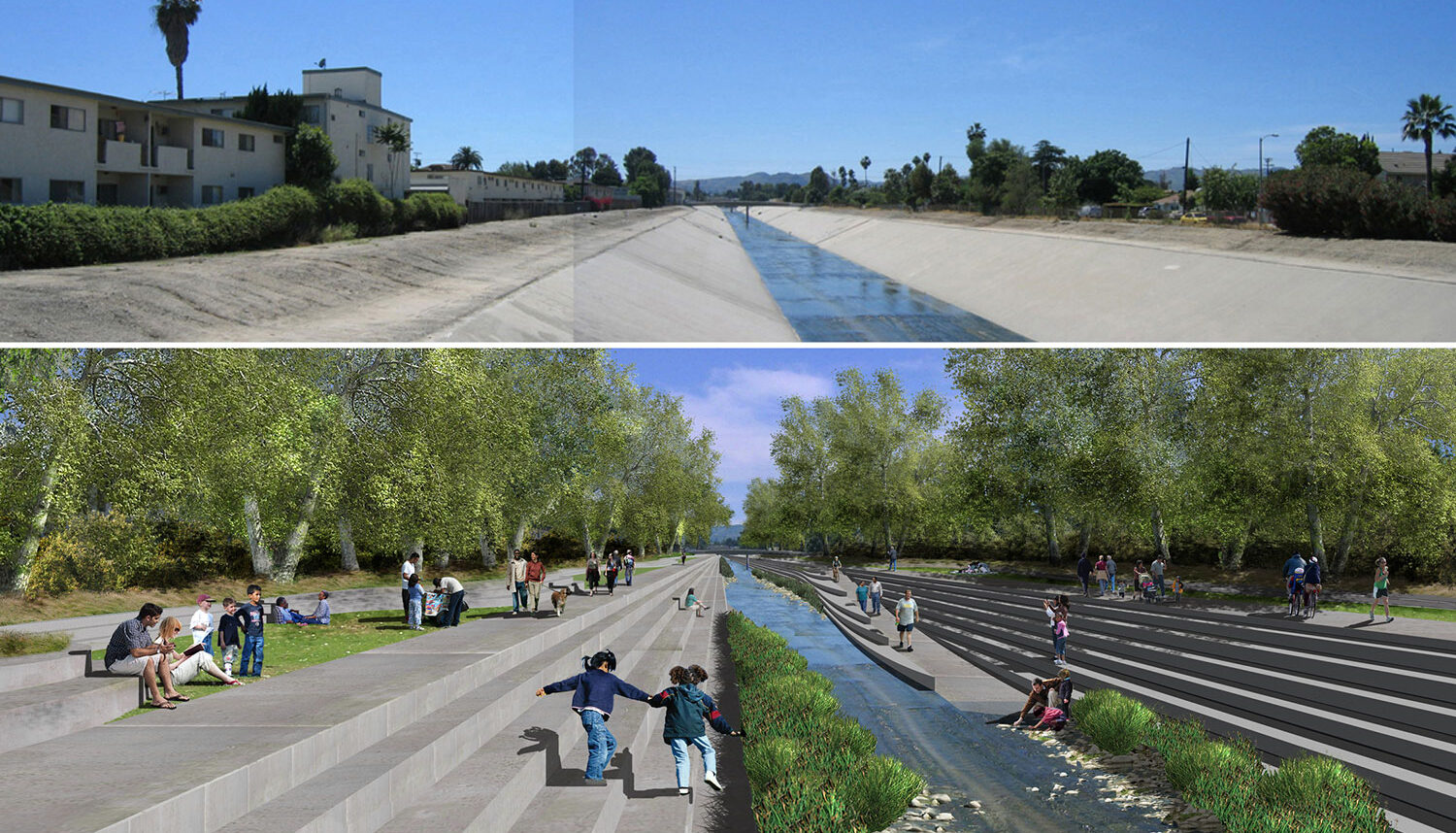
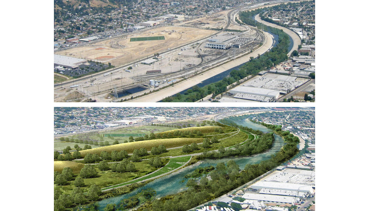
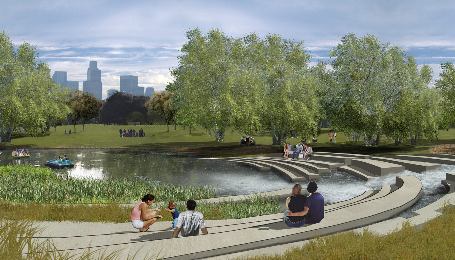
Revitalize the River: Restoration of the river’s ecological and hydrological functioning represents the ultimate, long-range goal, reintroducing vegetation to support birds and mammals, and ideally, developing fish passages and pools to restore steelhead trout habitat. Because this requires significant expansion of channel capacity and reduction in flow velocity, the Plan suggests a phased approach that introduces improvements first at the top of the bank, working down to the channel bottom as methods for storing and slowing flows are achieved. Public access and stormwater quality treatment are fully integrated into channel modifications.
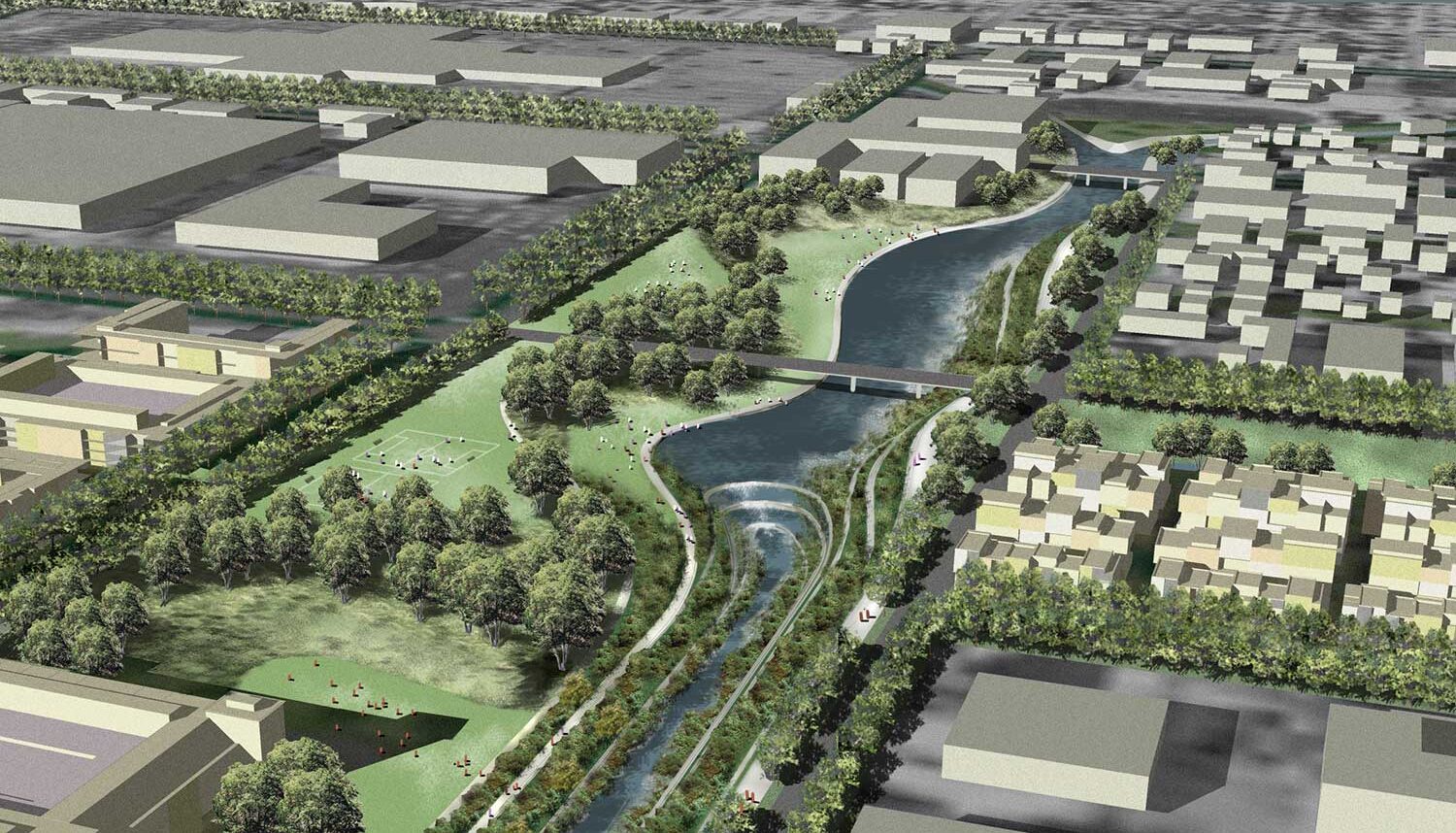
Green the Neighborhoods: Greening the neighborhoods extends the river’s influence into adjacent neighborhoods, creating a continuous river greenway that serves as the City’s “green spine;” reconnecting neighborhoods to the river through a system of “green streets;” recapturing underutilized or brownfield sites in park-poor areas as neighborhood parkland; incorporating stormwater management practices into all public landscapes; and enhancing river identity through signature bridges, gateways, and public art.
Capture Community Opportunities: Critical to realizing the goals of the Plan is the implementation of early examples that exhibit cross-cutting development possibilities. To demonstrate opportunities made possible with a revitalized river, the team identified 20 opportunity areas to illustrate what might be feasible through the implementation of various improvement scenarios, and five areas for further design development as prototypical scenarios.
Create Value: Making the River green and accessible is expected to transform an undervalued asset into a valued amenity. Estimates of economic benefits accruing to the proposed revitalization concepts for the five opportunity areas (combined, at full build-out) range from $2.7 to $5.4 billion in new development, 11,000 to 18,000 new jobs, and a long-term tax revenue increase that ranges from $47 to $81 million annually.
Project Team:
Tetratech – Lead, Engineering
Wenk Associates – Landscape Architecture, River Planner
Civitas – Landscape Architecture
Mia Lehrer + Associates – Landscape Architecture
HNTB Architecture – Planning
Client
City of Los Angeles Bureau of Engineering
Completion year
2007
Awards
American Society of Landscape Architects, National Honor Award for Analysis & Planning, 2008
American Institute of Architects California Council, Honor Award for Urban Design, 2008
American Institute of Architects, Honor Award for Regional and Urban Design, 2007
American Society of Landscape Architects California Chapter, President’s Award of Excellence for Planning and Urban Design, 2007
American Society of Landscape Architects Colorado Chapter, President’s Award of Excellence for Planning and Urban Design, 2007
The Waterfront Center, Project Honor Award in Long Range Plans, 2007
Related Work
The River Mile Redevelopment
Denver, CO

Confluence Park
Denver, CO
Steamboat Base Area Redevelopment
Steamboat Springs, CO