


Great River Passage
Saint Paul, MNComprehensive revitalization master plan for 17-mile section of the Mississippi River corridor in Saint Paul.
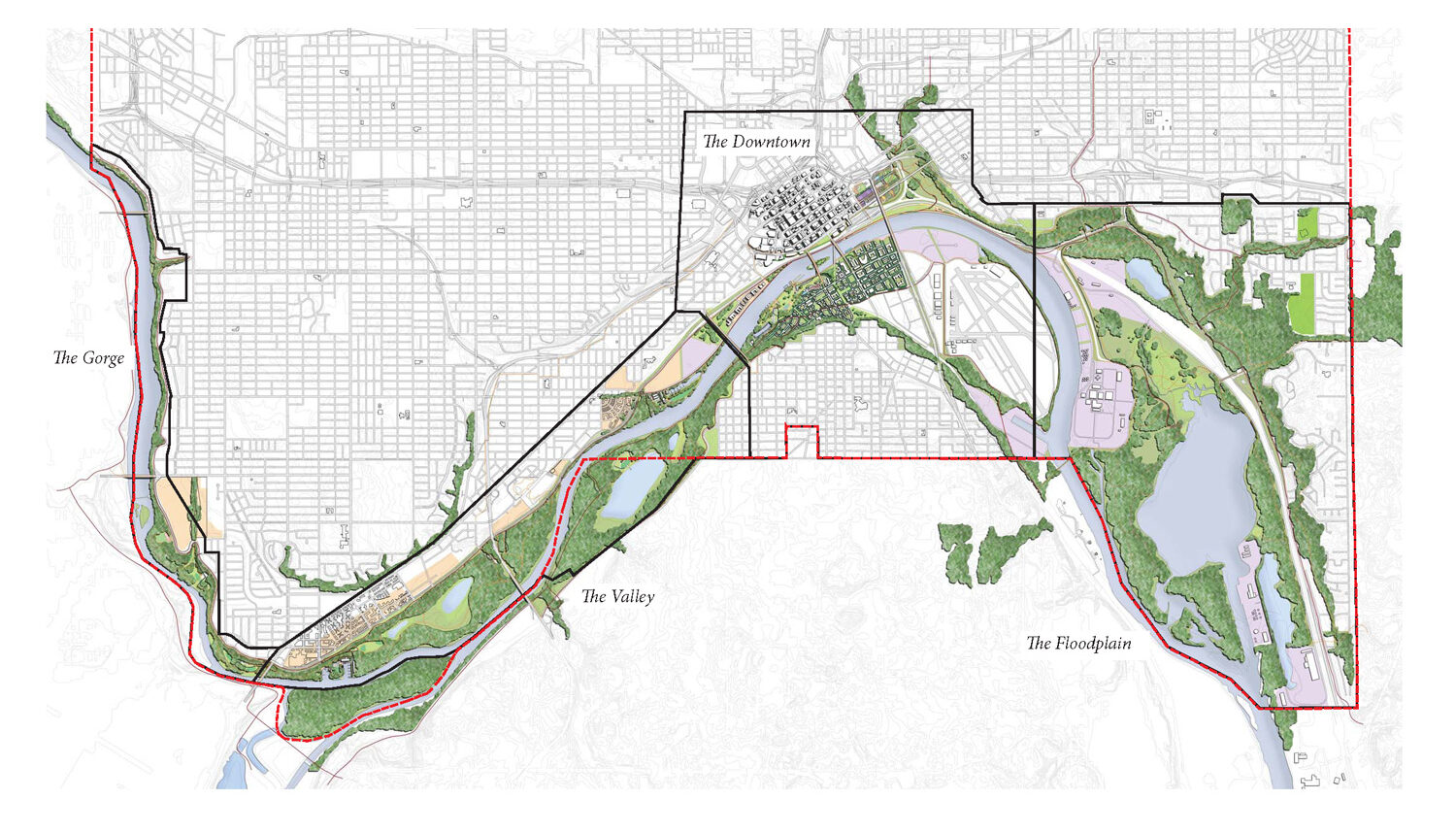
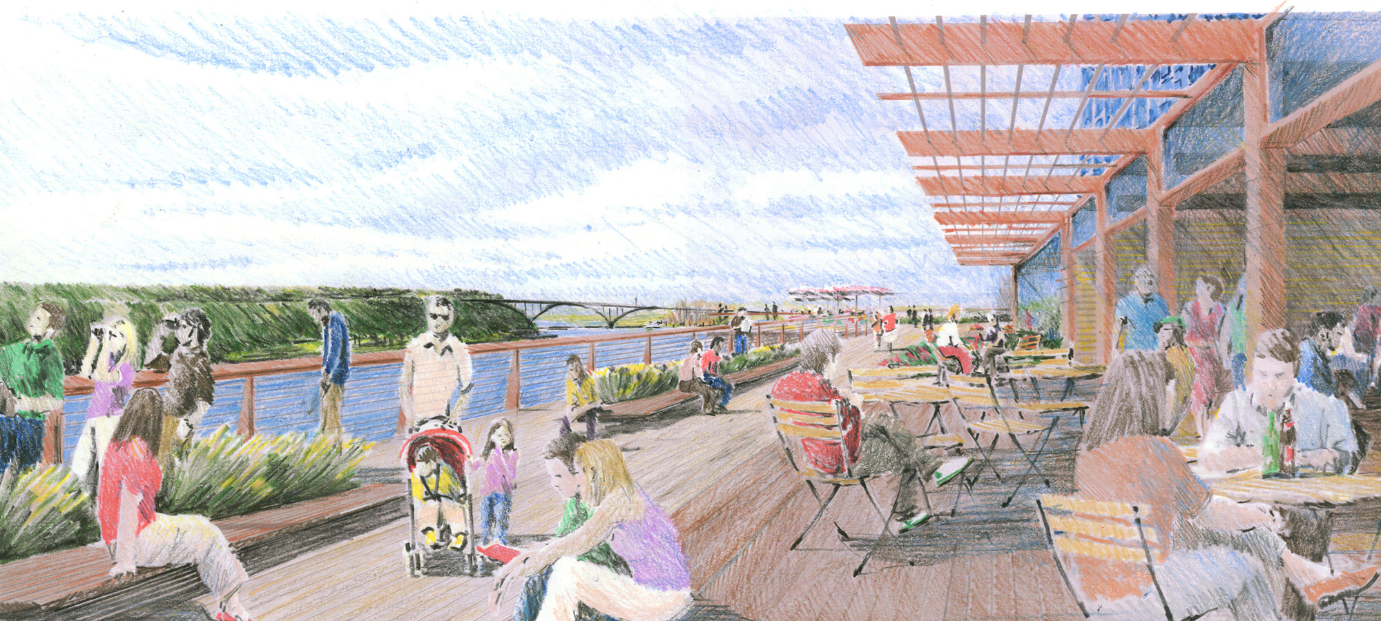
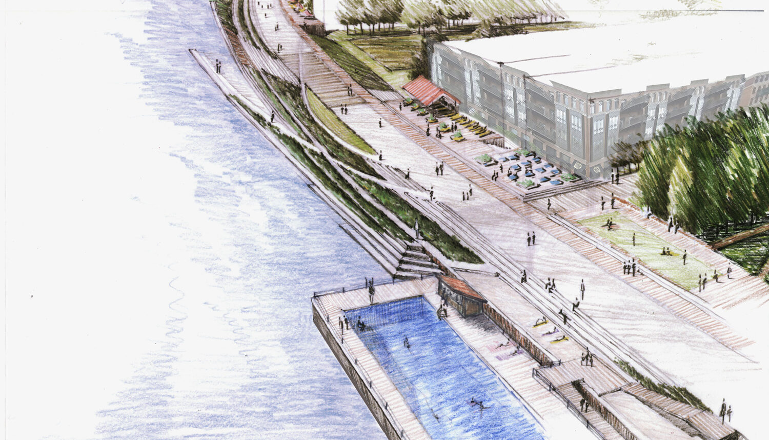
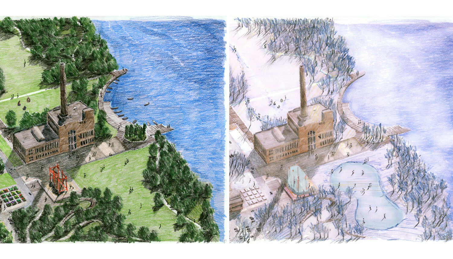
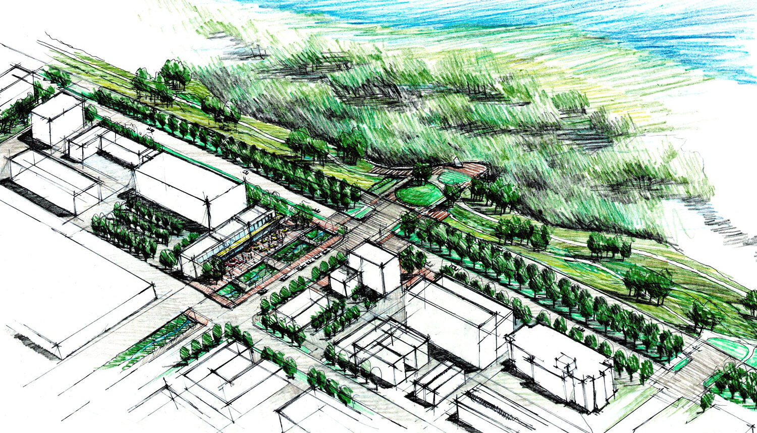
Transitions in industrial land uses, and ongoing efforts to revitalize existing neighborhoods and districts bordering the Mississippi River corridor, prompted the city of Saint Paul to prepare a comprehensive revitalization master plan for the 17-mile long corridor. Wenk Associates led the master planning effort that describes a vision for the corridor, described as The Great River Passage. The Plan envisions revitalizing the economic, social, recreational, and natural qualities of the corridor through creation of a series of districts. Revitalization of the districts will be guided by development principles that make the corridor “More Natural, More Urban, and More Connected”.
The plan, which expands on earlier planning efforts, focuses on the redevelopment of underutilized industrial lands, restoration and expansion of wildlife habitat, and expansion and enhancement of trails and recreational use areas. Stream restoration and water quality enhancements are an integral part of natural area restoration. The plan emphasizes improved walkability and connections to the river from adjacent neighborhoods. Specific implementation strategies and detailed plans for park improvements will create an integrated system of parks and natural areas that will define the image of Saint Paul as a River City into the next century. The master planning effort required coordination with other municipalities within the corridor, and complements a larger strategy, coordinated by the National Park Service, to create the Mississippi National River and Recreation Area.
Project Team:
Wenk Associates – Lead Consultant, Landscape Architect and Planner
Hoisington Koegler Group, Inc. (HKGI) – Architect/Urban Design
Barr Engineering Company – Civil/Environmental/Ecological
Charlier Associates, Inc. – Transportation and Trails Connectivity Planning
Mithun Architecture – Urban Design and Sustainability Strategies
HR&A Advisors – Economic and Management Strategies
Tunheim Partners – Marketing Strategy and Branding
Noble Erickson – Wayfinding and Identity
The 106 Group – Cultural and Historic Interpretation
Forecast Public Art – Public Art Consultation
Little and Company – Branding
Fountainhead Communications – Editor
Client
City of Saint Paul Department of Parks and Recreation
Completion year
2012
Awards
2013, The Waterfront Center, Merit Award for Planning
2013, American Society of Landscape Architects - Colorado Chapter, Merit Award for Design
Links
Related Work

The River Mile Redevelopment
Denver, CO

Confluence Park
Denver, CO
Steamboat Base Area Redevelopment
Steamboat Springs, CO