Menomonee River Valley Redevelopment and Community Park
Milwaukee, WIThe revitalization of a derelict, industrial river valley.
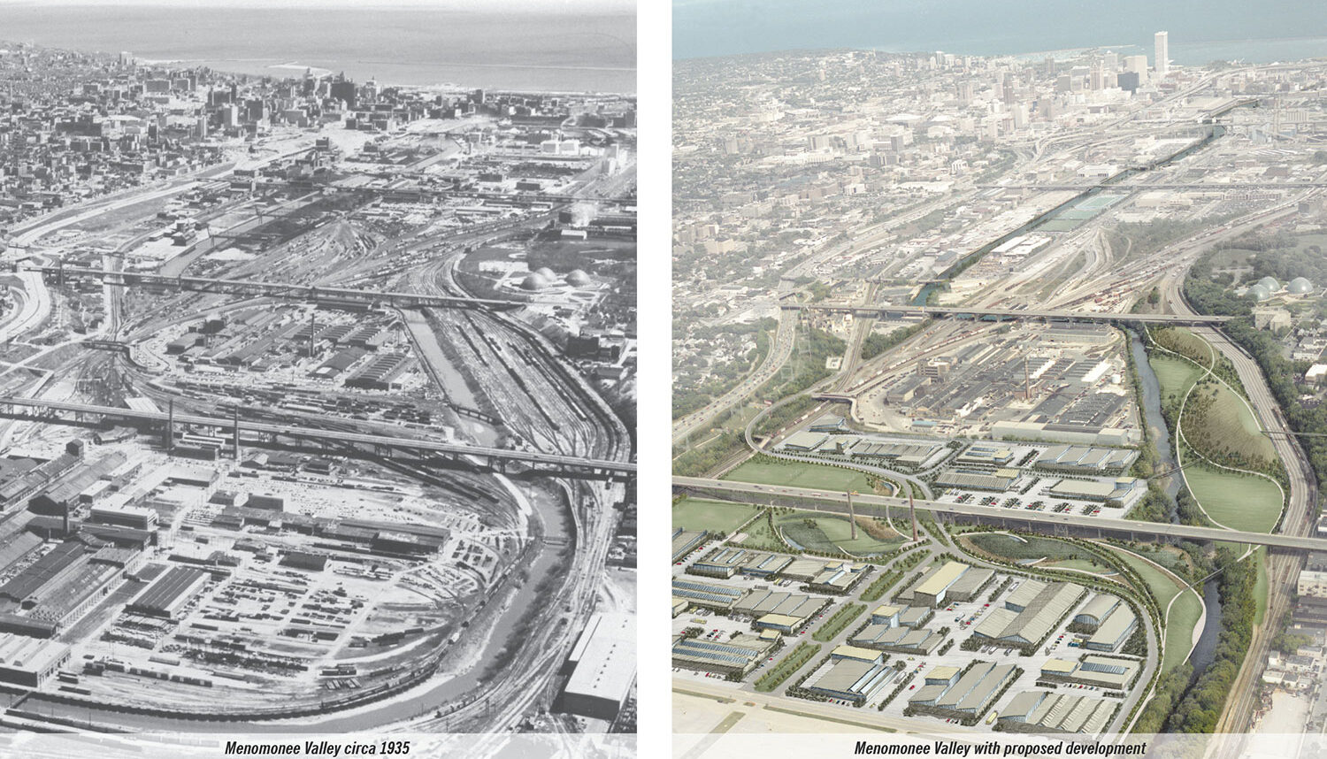
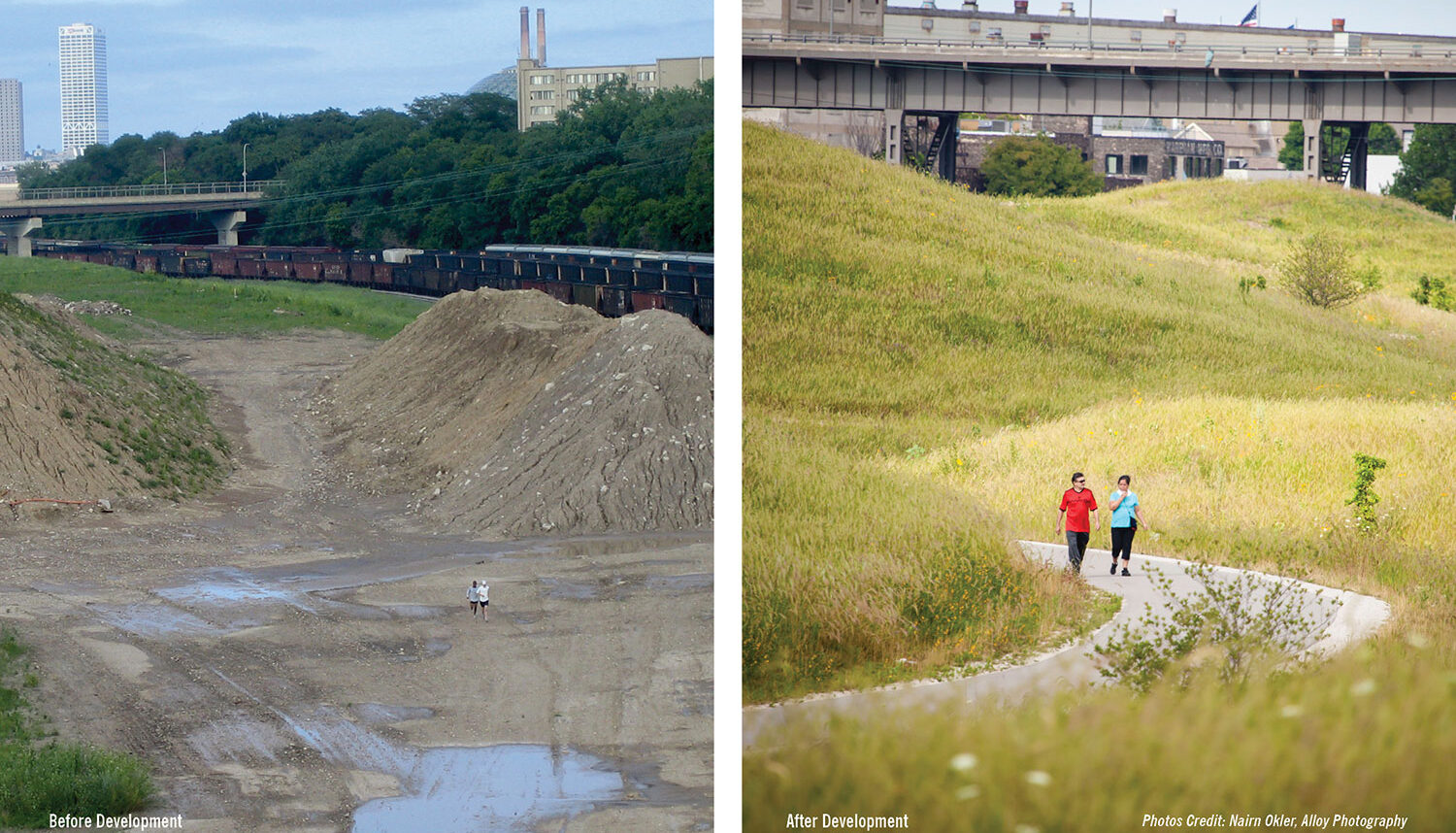
Once known as “Wisconsin’s biggest eyesore,” the former Milwaukee Road Shops and Airline Yards rail site located near downtown Milwaukee is now one of the largest brownfield redevelopment successes in Wisconsin history. For over ten years, Wenk Associates, worked with the City, the State of Wisconsin, and multiple nonprofit partners to transform the 140-acre site. What was once a marsh blighted by 125 years of fill and industrial contamination is now a job-rich, sustainably designed industrial center with expansive parks and open spaces lining the restored Menomonee River.
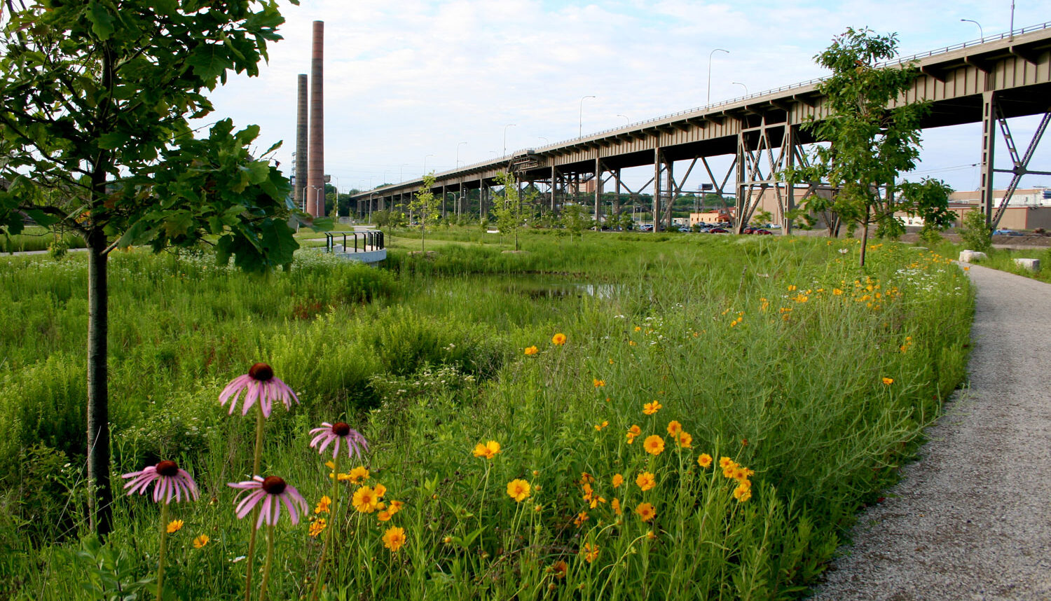
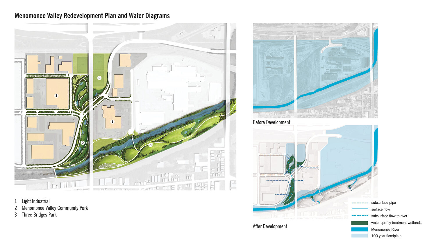
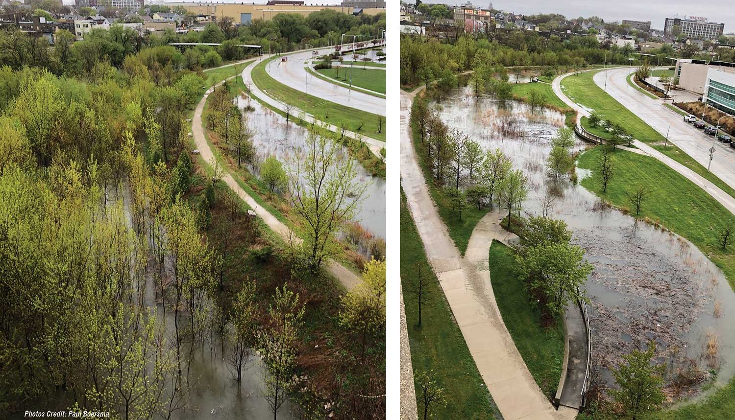
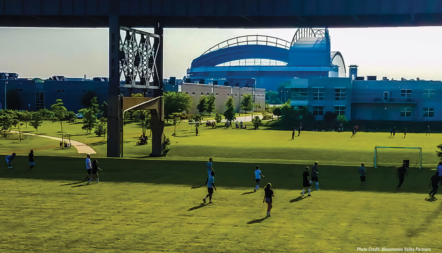
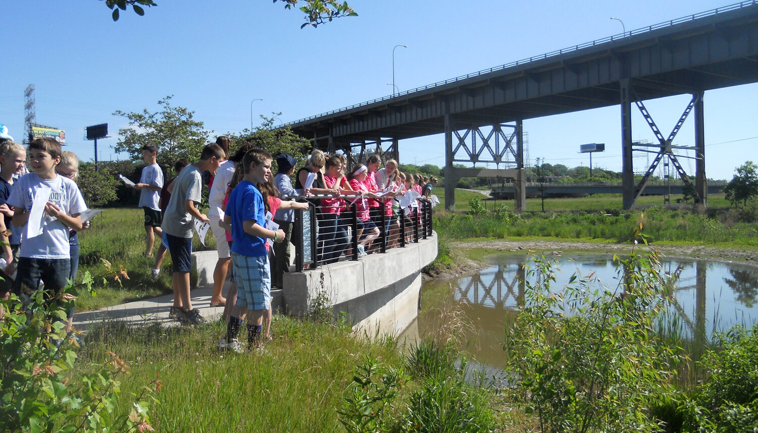
The area’s transformation provides much-needed jobs, parks, connectivity, and access to nature for adjacent neighborhoods. A more resilient pattern of development that reduces flood risk and cleans and infiltrates storm runoff from industrial areas within the parks supports a series of native Wisconsin landscapes, and incorporates areas for active recreation and environmental education. The River is more accessible and ecologically diverse.
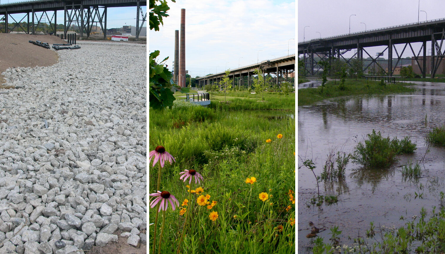
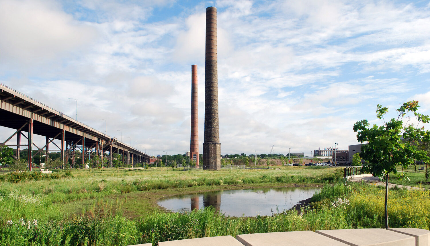
Menomonee Valley Community Park incorporates multiple opportunities for active recreation and integrates all stormwater treatment for the adjacent industrial development. The stormwater treatment areas, which occupy roughly half of the park area, are developed over capped contaminated soils, 18 inches (20,000 cubic yards) of concrete rubble generated from highway demolition, and a constructed soil profile that filters contaminated urban runoff. The treatment areas support a linked series of seven landscape typologies indigenous to Southern Wisconsin, which range from mesic prairie to swamp forest, and connect to the Menomonee River.
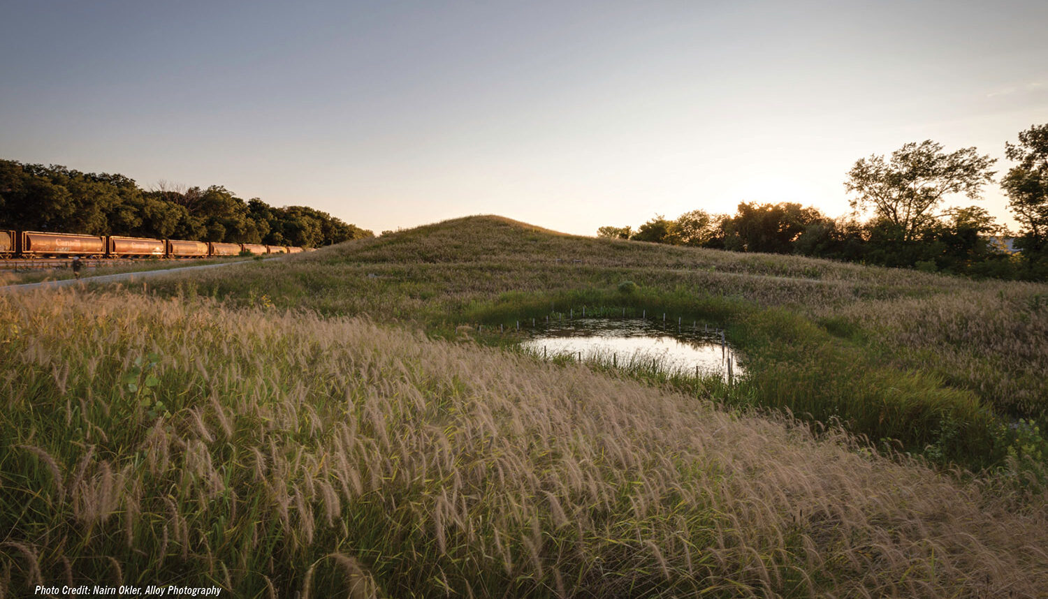
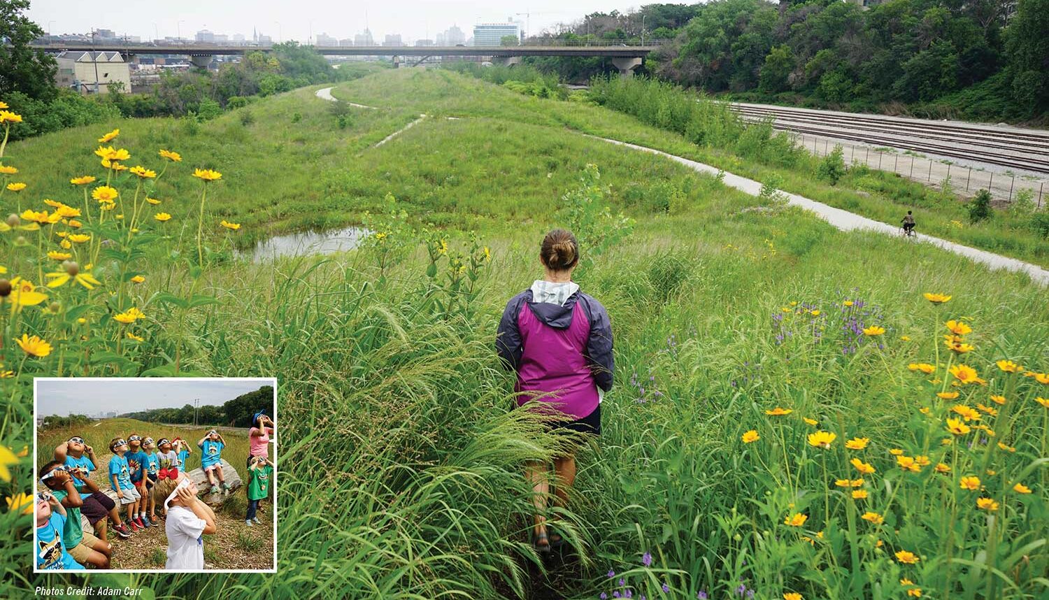
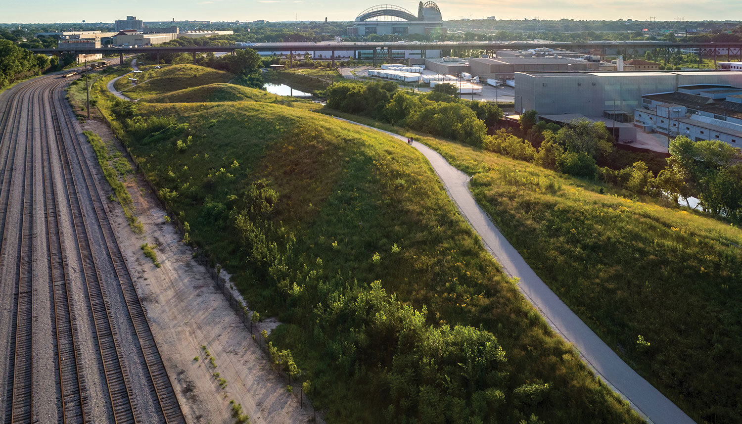
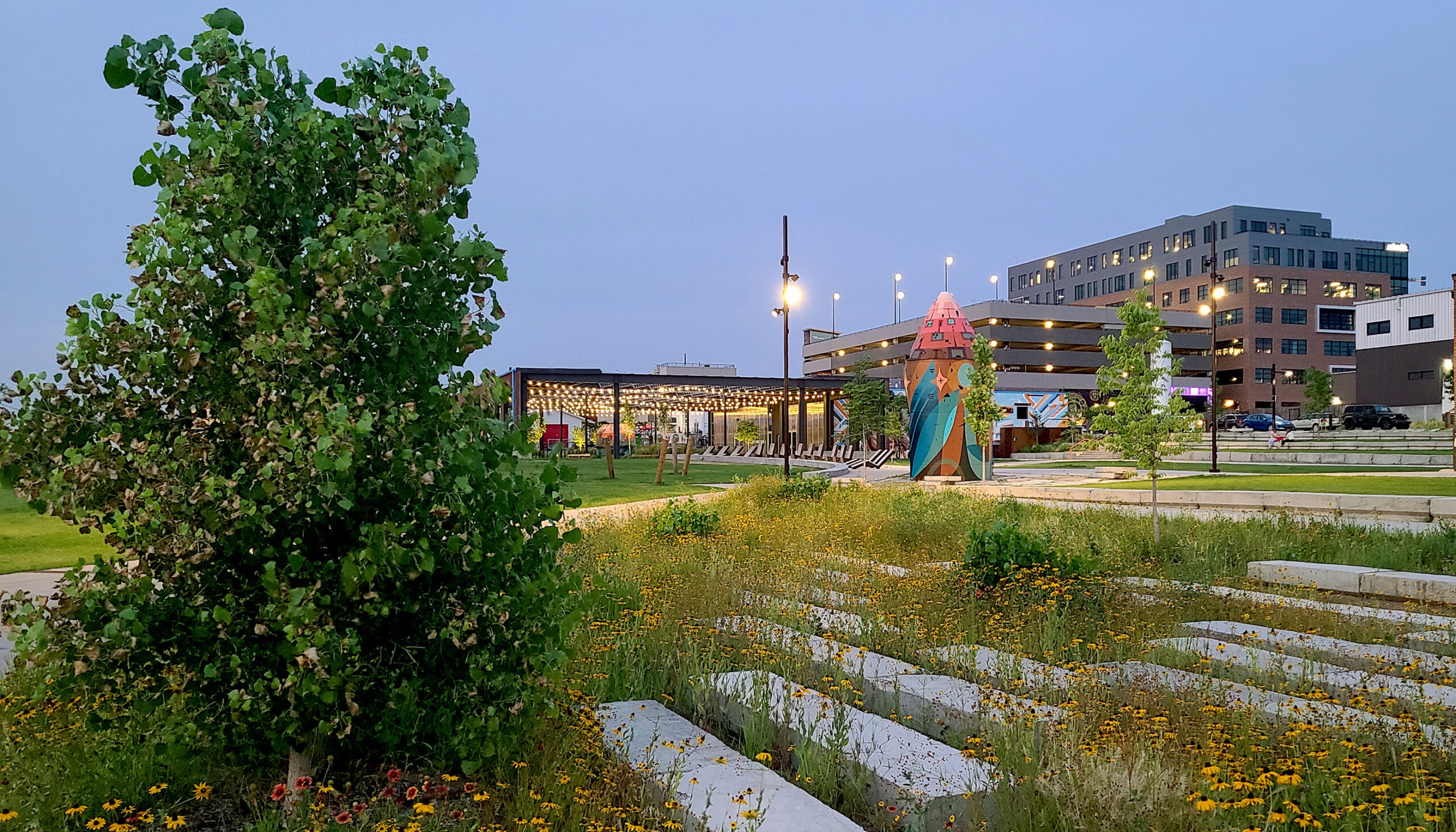
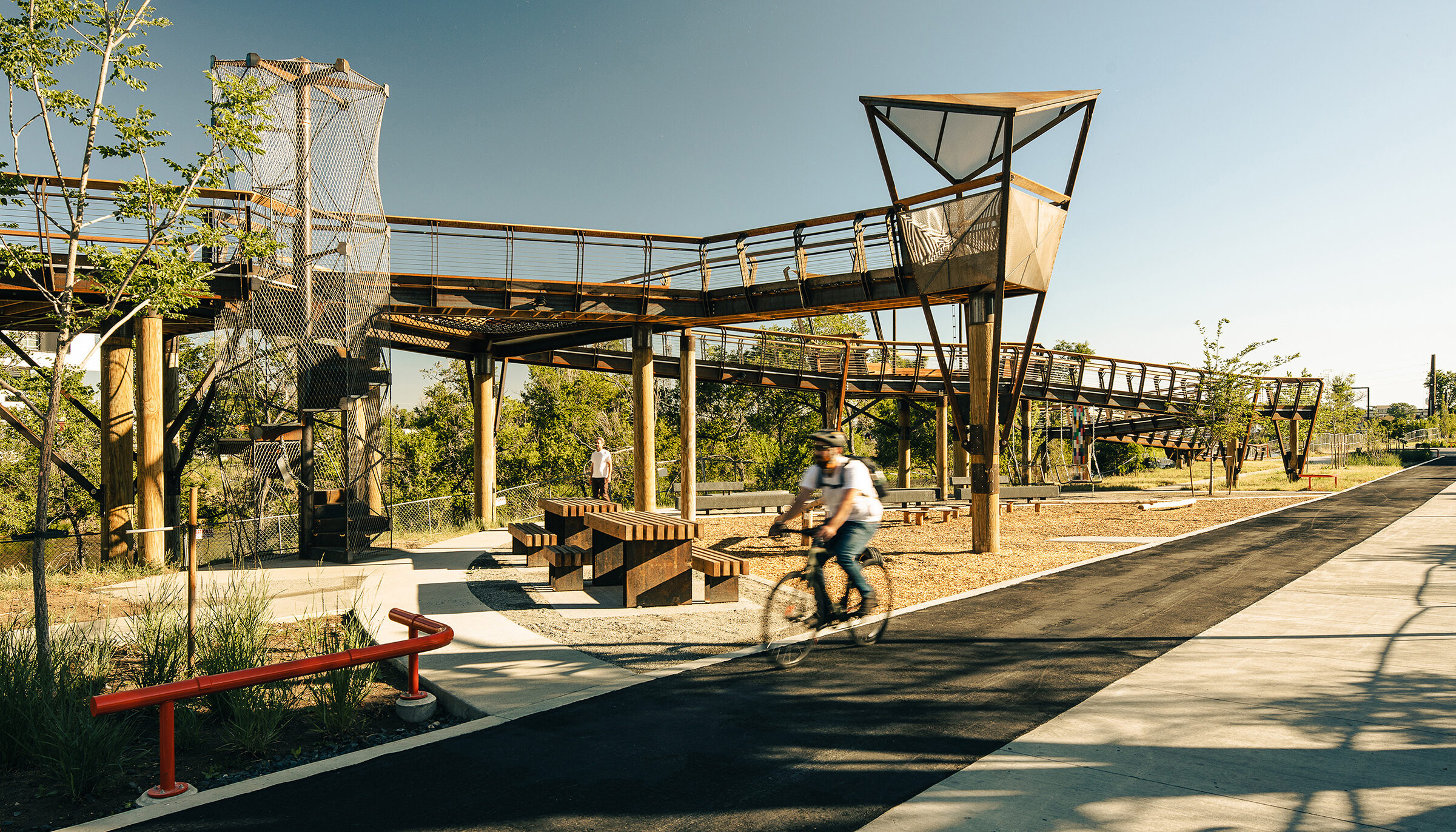
Three Bridges Park is a 24-acre open space formed by a series of hills created by capping 300,000 cubic yards of contaminated building debris. The open space mimics the landforms and ecology of Wisconsin’s glacial landscapes, and the local valleys that link the uplands to the Menomonee River. Three pedestrian bridges and a restored underpass (that originally connected the railyards to adjacent neighborhoods) provide multiple access opportunities for local residents.
Project Team:
Menomonee Valley Community Park
HNTB – Site Infrastructure
CH2M Hill – Environmental Remediation Planning
Edgerton Contractor, Inc. – General Contractor
Applied Ecological Services – Landscape Restoration
Marek Landscaping – Landscape Contractor
Three Bridges Park
Benesch – Civil Engineering
Lunda Construction Company – General Contractor
Marek Landscaping – Landscape Restoration Plan
Conservation Land Stewardship, LLC – Landscape Contractor
Client
Menomonee Valley Partners, Inc.
City of Milwaukee
Completion year
2012
Awards
Waterfront Center Award, Honor Award, 2016
WTS Wisconsin Recognition Award, Project of the Year, 2013 (Three Bridges Park)
American Trails Organization, Trail Advocacy Award(Hank Aaron State Trail), 2010
USEPA Conference, “People’s Choice” Award for Brownfield Redevelopment, New Orleans, 2009
Brownfield Renewal Magazine, Grand Prize for Environmental Remediation, 2009
Mayor or Milwaukee’s Urban Design Awards, Winner, 2007
Wisconsin Builder Awards, “Top Projects of 2007”, 2007
American Council of Engineering Companies (ACEC) of Wisconsin Engineering Excellence Awards, “Best in State” in Environmental, 2007
Sierra Club nomination, One of 10 “Best New Development Projects”, 2006
American Society of Landscape Architects, National Merit Award for Analysis and Planning, 2003
Related Work
Salt Lake City Green Loop
Salt Lake City, UT
Arkins Park (RiNo ArtPark)
Denver, CO
Arkins (RiNo) Promenade
Denver, CO